This project focuses on the development of a coordination and documentation system for fire stations. Therefore we have designed a digital application which enables task-orientated user guidance for operations coordinators. In every phase of an operation the required information is made available in order to reliably and efficiently coordinate and document operations and to avoid the visual overload of the current procedure.
Period
Mar 23 – Jul 23
Context
Lean Design, Hochschule für Gestaltung
Team
Sandy Kübler, Hannes Bruß & me
Tools
Figma
Play Video
In 2020, there were almost 4.1 million firefighting operations in Germany. In these operations, every second count and can mean the difference between life and death.
The fire service is an indispensable institution in civil defence and plays a crucial role in dealing with emergencies and disasters. Their activities are diverse and range from firefighting and technical assistance to rescuing people and animals. But currently, many fire service processes are inefficient and unnecessarily complicated.
#01 Define
Role of an operations coordinator
The operations coordinator is based at the fire station and has an important role in planning and monitoring operations. He receives emergency calls from the control centre and coordinates resources. He collects information about the emergency location, analyses the situation and makes initial decisions about the course of the operation. He communicates with the operations commanders on site and helps them to carry out rescue operations. Although they operate in the background, they help to ensure that the fire service can fulfil its tasks efficiently and safely.
#02 Research
Current working environment
For this project, we worked together with the fire station in Schwäbisch Gmünd and visited them regularly. The working environment of the fire station and the programmes used there make it difficult for the operations coordinator to coordinate efficiently. The workstation of the operations controller includes 10 screens displaying various monitoring and management information, as well as numerous analogue lists on the walls. These lists contain important information, such as the vehicle deployment order based on the alarm keyword, information about the city’s public buildings, and the order to respond in case of an additional alarm.
#03 Key insights
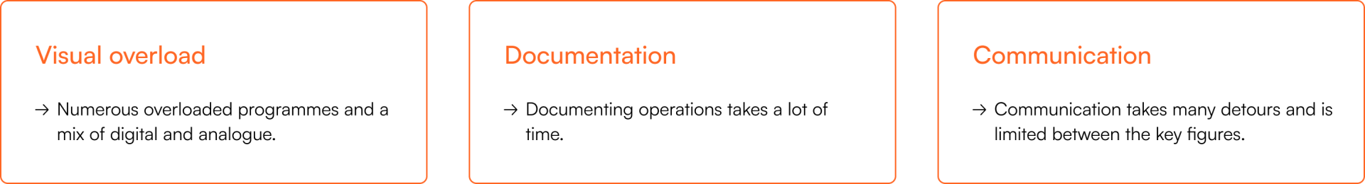
Pain points of the operations coordinator
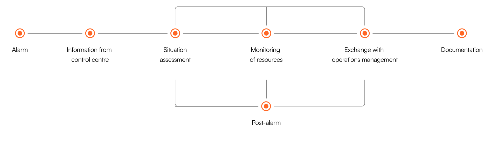
#04 Work flow
Procedure of an operation
At the fire station in Schwäbisch Gmünd, we got a detailed insight into the work of the operations coordinator. We were also able to join the operations coordinator live at two operations.
In the fire station, every second is crucial and the work takes place under extreme conditions and maximum stress. Routines are therefore essential for firefighters to act quickly and correctly. The operation process therefore also looks very linear for the operation coordinator. The process can be divided into three phases: Alerting, Coordination and Documentation. A cyclical process takes place in the “coordination” phase. The constant monitoring of resources is necessary in order to react to a change in the situation and, if necessary, to alert additional emergency forces.
#05 Prototype
Main features of our application
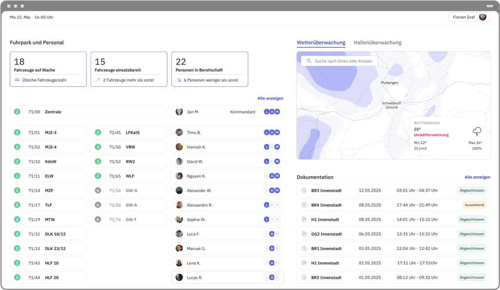
Overview of everything even when there is no operation
If there is currently no operation, the so-called idle screen is visible. It displays an overview of the vehicle fleet and personnel. Here, it is important to be able to see the general operational readiness.
A weather map gives an overview of the weather conditions in the local area.
Additionally, documentation of past operations can be viewed and edited.
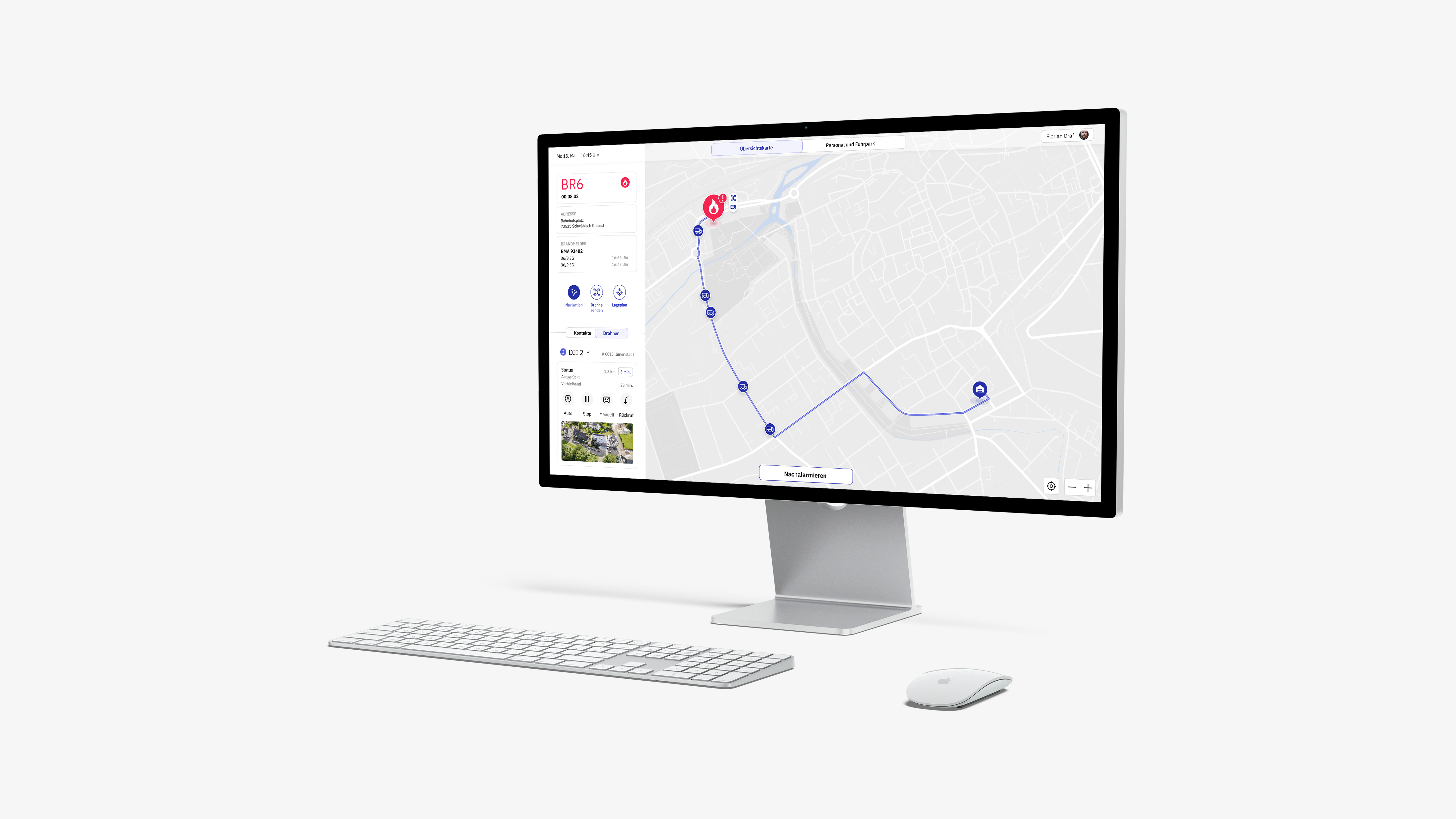
All important information and resources quickly accessible during an operation
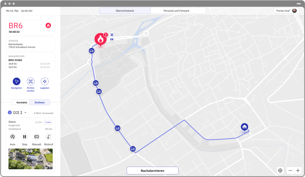
During an operation, the operation coordinator can permanently see all important operation information.
While the alerted personnel are arriving at the control centre, operations coordinators already have the opportunity to find the best route to the emergency location and transmit it to the emergency vehicles. Even the status of the vehicles on their way to the emergency location can be tracked from here.
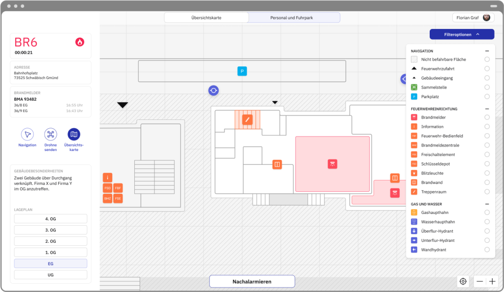
Different depths of information about the operating location
Different zoom levels on the map reveal different levels of information depth. For example, the positions of hydrants are displayed or a site plan of the location itself is shown.
The site plan provides a detailed view of the building with an overlay of important facilities and dangers. Data from linked sensors, such as fire detectors, is displayed live here.
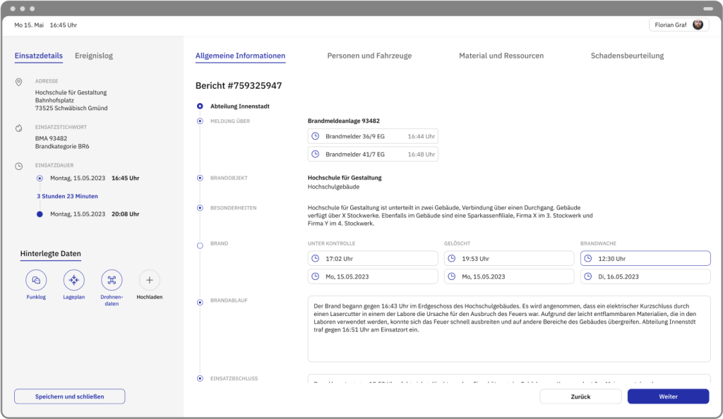
Automated and fast operation documentation
This solution is based on the assumption that a large amount of linked data, e.g. from sensors in emergency vehicles or from digital tools used by the emergency services themselves, will be available in the future. This would make it possible to streamline the documentation process and reduce the effort involved significantly.